Offshore Wind Energy Northeast US

Marine Geophysical Cable Route Survey

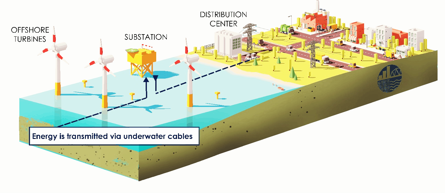
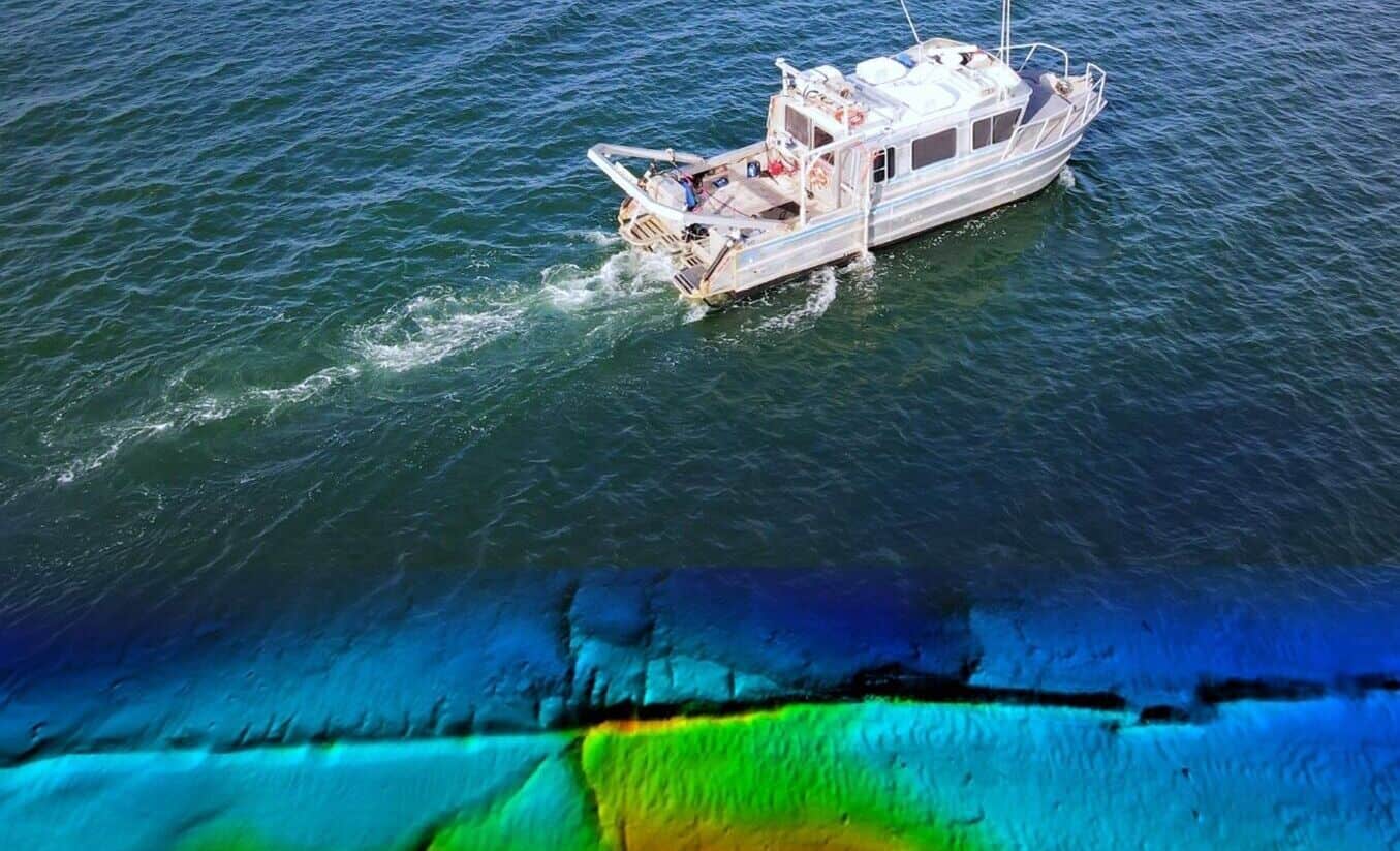
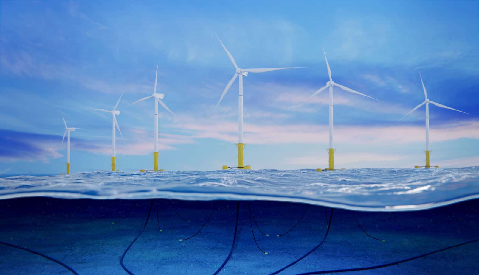
The planning, installation, and assessment of subsea offshore wind energy cables presents various planning and procedural challenges that can be solved with in-depth integrated hydrographic, geophysical, and geotechnical data. In order to assist in bringing the renewable energy source to the Northeast United States, McLaren Engineering Groups’s survey and mapping team provided state-of-the-art marine geophysical transmission cable route surveys and detailed 3D deliverables. The collection of data along the approximately two-mile route gave our energy clients a full and detailed picture above and below the seabed to best plan an accurate cable route site layout.

Laying transmission cables from land to sea is costly. As such, there is little room for error or re-work should unforeseen geophysical obstructions present along a proposed route. The solution for determining any potential impediments to the site layout and minimize the overall transmission cable length involves providing detailed analysis of subsea conditions and 3-D modeling of geological obstructions, man-made debris, environmentally and politically sensitive areas in order to ensure the viability of the proposed cable route corridor.

Offshore Transmission Cable Route Lines

Transmitting the power of offshore wind’s green energy is accomplished through the installation of a network of underground cables buried beneath the seafloor. Turbines offshore capture the kinetic energy in wind and convert it into electrical power. Electricity from the wind turbine generator travels to a substation via transmission cables where it is converted into extremely high voltage (between 155,000 and 765,000 volts) for long-distance transmission on the transmission grid. This grid comprises a series of power cable lines that connect the power sources to distribution centers. There the high voltage power from the transmission grid is then converted to a lower voltage power (typically in the region of 10,000 volts) and distributed.

Geophysical Cable Route Survey

McLaren tackled the offshore energy project using the most advanced techniques and equipment to help verify the cable route’s suitability, and gather the additional detailed information required to undertake the final route engineering with the use of the latest software and survey methods, including accurate geodetic control, GNSS, hydrographic and geophysical surveying.

Utilizing a custom-built nearshore survey vessel, the marine cable route surveyors’ geophysical tools (such as echosounders, sonar, sub-bottom profilers, and magnetometers) provided comprehensive sets of data which were charted and incorporated into our cable routing GIS software. Geophysical sub-bottom profiling (single-channel seismic) sonar provided the critical subsurface information of soil structure, rocks, and unseen route obstructions to be integrated with the geotechnical samples.

McLaren’s survey team took into consideration everything from local oceanographic conditions and geological characterization to create the most accurate and advanced data and deliverables for precise cable layout plans to support the Northeast’s push for renewable wind energy.

Location
Northeast, USA
Year Completed
Ongoing
Markets
Client
Confidential