|
|
Solutions From Concept To Completion
Structural Engineering
Site Solutions From Concept To Completion
Civil Engineering
Solutions Where Land Meets Water
Marine + Coastal
Solutions From Procurement To Completion
Construction Engineering
Structural + Mechanical Specialists
Entertainment Engineering
Consultation, Design + Inspection
Facade + Building Envelope
Soil + Foundation
Geotechnical Engineering
Investigation + Litigation Support
Forensic Engineering
Arts + Entertainment
Live Performances
Museums + Art Displays
Pop-Ups
Signage
Studios + Sound Stages
TV + Film Production
Theaters
Theme Parks + Playplaces
discover
Education
Colleges + Universities
Private + Specialty Schools
Public K-12
discover
Energy
Solar Energy
Transmission Infrastructure
Wind Energy
Oil + Gas
discover
Government
Municipal
State
Federal
discover
Healthcare
Senior Care
Hospitals
Outpatient Facilities
discover
Industrial
Heavy Industrial
Warehouse + Distribution Centers
Industrial Ports + Terminals
discover
Ports + Coastal
Berths, Piers + Wharves
Bulkheads
Esplanades
Ferry Landings, Ship Terminals
Floating Structures
Ports + Terminals
Marinas + Breakwaters
Transfer Stations
discover
Public Infrastructure
Bikeways + Trails
Garage + Parking Facilities
Parks + Public Spaces
Recreational Spaces
Streetscapes
Utility Infrastructure
Water + Wastewater
discover
Real Estate Development
Commercial
Community Facilities
Mixed-Use
Multifamily Residential
discover
Transportation
Airports
Bridges
Ports + Terminals
Rail Transportation
Roads + Highways
Ropeway + Linear Infrastructure
discover
Floating Harbor Wetland
Multimodal Processing Plant
416 + 420 Kent Dynamic Highrise
Wittpenn Bridge
Tiffany Crane
LaGuardia Airport Terminal B
NYC Ferry
Orlando Airport LED Displays
A leading full-service engineering firm renowned for our trusted, high quality, and innovative approach to solving complex challenges.
Bathymetric Mapping of California Reservoirs

Bathymetric Mapping
of California Reservoirs

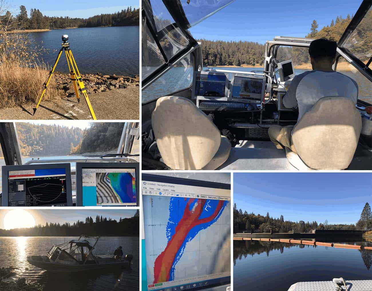
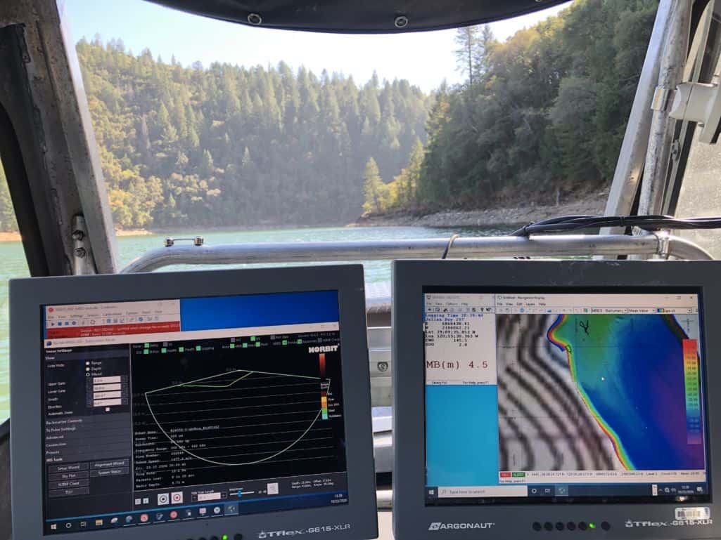
Our surveyors have been active performing cutting-edge bathymetric mapping to investigate seafloor conditions and capacities of several California reservoirs. Utilizing our Multibeam Echosounder (MBES) and integrated mobile LiDAR system, McLaren conducted highly-detailed 3D scans above and below the water. The MBES emits sound waves in a fan shape beneath the boat’s hull using beamforming to extract directional information from the returning soundwaves. Several transducers allow for a large swath of area to be surveyed from a single ping, making the hydrographic survey fast and more accurate.

Simultaneously, the LiDAR technology utilizes remote sensing in the form of a pulsed laser to measure ranges to complete the full 3D model of each reservoir. This bathymetric mapping method for acquiring the data sources increases the accuracy of the water volume capacity calculations while also identifying potential erosion or sediment deposit related issues.

Bathymetric Mapping of California Reservoirs